Insider's Guide: Hiking Around Hungary - Special Signs Explained
- 5 Jul 2023 9:47 AM

Many routes snake through the picturesque Buda hills and beyond, and form part of the Duna-Ipoly National Park that stretches from the caves beneath Buda Castle all the way to Esztergom, where it is based.
For hikers, blue is not the only colour – there are red, green and yellow markings, too, plus various shapes and symbols. While Hungarian adventurers will be familiar with them, first-time expat hikers may not – so here’s our guide to all the hiking signage in Hungary and what it means.
Following the colours of hiking trails in Hungary
Trail markers in Hungary are colour-coded, each representing a different kind of trail. The most common ones you’ll see are:
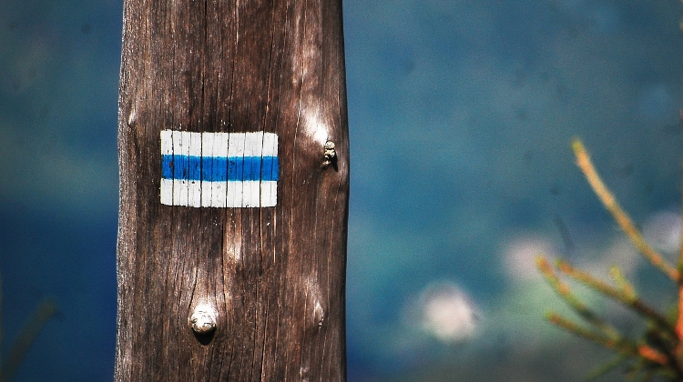
Blue: These indicate long-distance hiking trails and cover a significant portion of the country thanks to an initiative organised in the 1930s. The network wasn’t officially unveiled until 1938, partly to mark the 900th anniversary of the death of St Stephen, the nation’s founder, partly because it took so long to agree access with land owners.
The ‘National Blue’ has long since entered the national consciousness, and every weekend, hundreds follow these stripes – white in the middle of bands of blue – to admire a particular natural or historic attraction.
Red: These signify local or regional trails, shorter in length than their blue counterparts whose paths they often cross. This makes them suitable for day hikes or weekend breaks, particularly if you combine them with a certain stretch of the National Blue
Green: These indicate nature trails, which Hungarians refer to as ‘study trails’, and highlight an area of environmental or historical significance. Signboards will be set up along the way, providing valuable information why the area’s important and what to look out for – not all have English translations, so having a Hungarian speaker in your hiking group is always handy!
Yellow: These usually refer to national parks and protected areas. Signs give hikers guidelines as they explore these nature reserves, outlining the particular flora and fauna that makes the surroundings unique, hence their protected status.

Signs and symbols of hiking trails in Hungary
As well as colours, shapes and symbols offer additional information to help hikers on their way. These include:
Arrows: These point you in the right direction, indicating you’re on the right path, usually feature the trail’s respective colour.
Numbers: Like roads, long-distance trails have their own number by which they are identified. The figures are also shown on the trail markers, allowing hikers stay on the right track if they’re on extended getaways.
Crossed bars: These signify that the path ahead is temporarily closed or impassable for one reason or another, perhaps because of bad weather, maintenance work or other safety concerns.
Circles: These useful symbols show the intersection where different trails cross. The colours or symbols within them also aid hikers in choosing the right path to follow afterwards.
Triangles: Look out for these, as they mean that there’s a significant point of interest up ahead, perhaps a vantage point with a particular view or a spot of outstanding historical interest.
Squares: Many hikers are pleased to see these shapes, as they signify rest or picnic areas, where they can open their knapsack and break out the sandwiches surrounding by trees and fields. There may even be benches installed for this very purpose.
Look out for our guide to top hiking routes in Hungary - including the historic pilgrim trails.
Words by Peterjon Cresswell for Xpatloop.com
Peterjon has been researching the byways of Budapest for 30 years, extending his expertise across Europe to produce guidebooks for Time Out and his own website liberoguide.com


LATEST NEWS IN getting around